China's administrative division data constitutes crucial foundational geographic information. While numerous sources provide national administrative division data, openly accessible high-quality datasets remain scarce. To address this gap, Ruiduobao Geographic Space has developed a set of high-quality administrative division data spanning 2013-2023 with open accessibility. This dataset utilizes the 2022 county-level administrative division data from the National Fundamental Geographic Information System as its vector base, supplemented by Amap (Gaode) and Tianditu administrative division data. It references historical administrative divisions officially published by the Ministry of Civil Affairs as attribute foundations, featuring long temporal coverage, rich attributes, accurate national boundaries, and continuous updates.
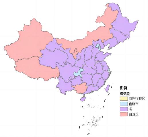
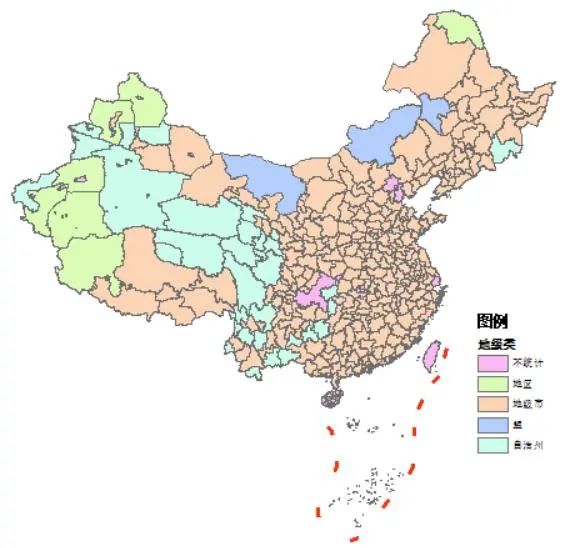
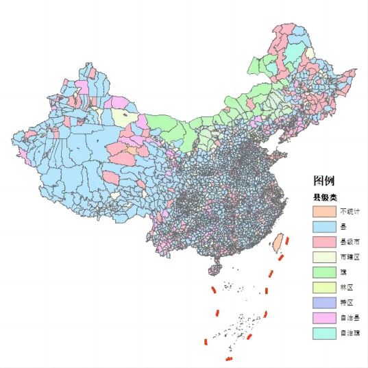
The statistical cutoff date for this dataset is February 12, 2023, containing provincial, municipal, county-level vector SHP data, along with national boundaries and the nine-dash line. The data was sequentially compiled from 2013 to early 2023 based on the 2020 administrative division basemap. As of January 1, 2023, China comprises 34 provincial-level units: 4 municipalities directly under the central government (直辖市), 23 provinces (省), 5 autonomous regions (自治区), and 2 special administrative regions (特别行政区). At the prefectural level, there are 333 units: 293 prefecture-level cities (地级市), 7 regions (地区), 30 autonomous prefectures (自治州), and 3 leagues (盟), with 38 vector elements excluded from statistics (e.g., Beijing Municipality, Macau Special Administrative Region, Ding'an County under provincial jurisdiction). At the county level, China contains 2,843 units: 1,301 counties (县), 394 county-level cities (县级市), 977 urban districts (市辖区), 117 autonomous counties (自治县), 49 banners (旗), 3 autonomous banners (自治旗), 1 special district (特区), and 1 forestry district (林区), with 9 vector elements excluded from county-level statistics (e.g., Hong Kong Special Administrative Region, prefecture-level cities without county-level units like Zhongshan and Dongguan).
Authorized by Ruiduobao Geographic Space, this dataset is included in the public data repository for academic access. Original data materials can be viewed and downloaded via the Ruiduobao Geographic Space official account or through the download link at the end of this document.
Data Processing Workflow

Data Update Notes
- Boundary modifications for early 2023 administrative divisions incorporate reference materials including the 2021 National Fundamental Geographic Information data (currency date 2019), 2013 administrative division data, 2013 township boundary data, 2022 Amap township administrative divisions, and 2022 village-level vector data from Henan and Jiangxi provinces (via Tianditu). All jurisdictional adjustments between administrative units reflect official Ministry of Civil Affairs records, excluding temporary trusteeship or delegated management scenarios.
- Notable 2022 county-level or higher jurisdictional trusteeship adjustments include:
- Kunming City trusteeship of Mengla County's Mohan Town in Xishuangbanna Dai Autonomous Prefecture
- Tibet's Konggang New Area management transfer from Lhasa to Shannan
- Lanzhou New Area's delegated management of Yongdeng County's Shangchuan Town
- Zhengzhou Airport Zone's trusteeship of Weishi County's Weichuan and Daying Towns in Kaifeng
- Luoyang's Baimasi Town trusteeship transfer from Luolong District to Chanhe Hui District
- Redistribution of高新区-administered towns to Luolong and Jianxi Districts
Notably, administrative trusteeship (托管) differs fundamentally from permanent jurisdictional transfer (划入). Trusteeship represents temporary arrangements subject to change, while jurisdictional transfers are typically permanent. Thus, trusteeship zones are not reflected in this dataset.
- Jinfeng District boundaries underwent modifications during 2015-2022.
Temporal Coverage
January 2013 - February 2023
Attribute Fields
County-level vectors contain multiple attributes as follows:
Prefectural-level vectors contain multiple attributes as follows:
Provincial-level vectors contain multiple attributes as follows:
Sample Data
- Provincial-Level Categories
- Prefectural-Level Categories
- County-Level Categories
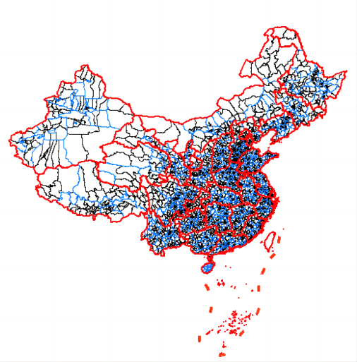
- Composite Visualization
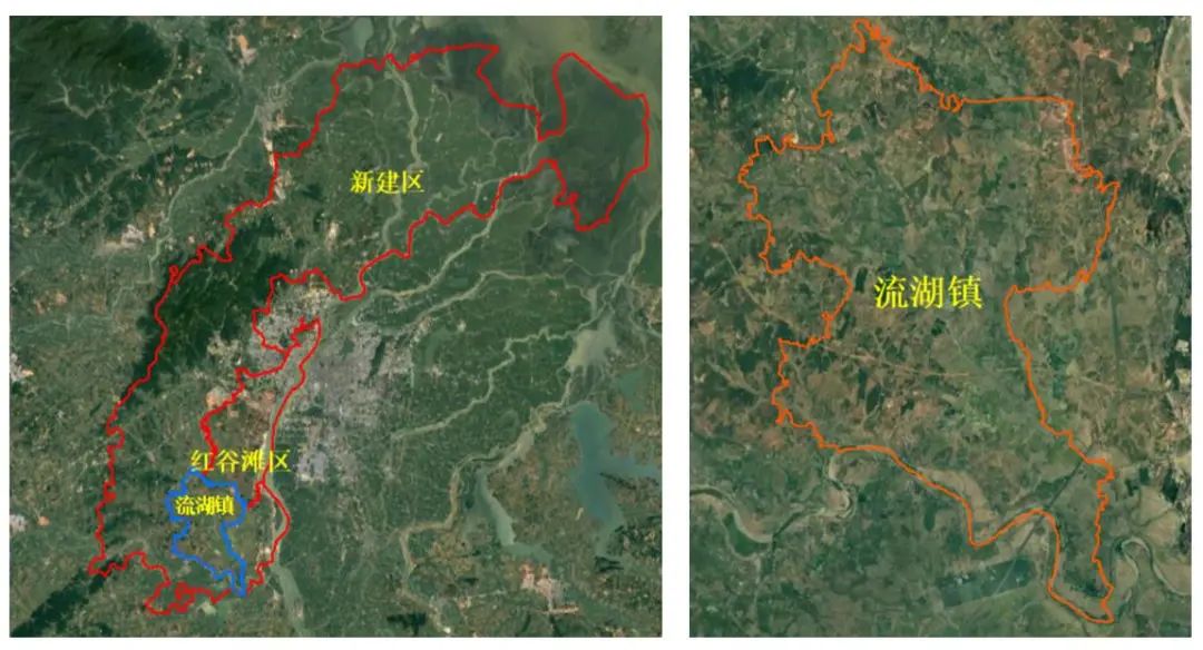
- Boundary Modification Examples
Example 1:
Liuhu Town in Honggutan District (Early 2023)
Example 2:
Gangli Township and Dama Township in Xinzheng City (Early 2023)

Update Frequency
Annual updates with periodic revisions to historical data.
