
Earthquakes rank among the most frequent and devastating natural disasters globally, presenting a significant challenge to human survival and development. Seismic hazards exhibit the following prominent characteristics:
- Catastrophic Destructiveness. Earthquakes cause damage to mountains, ground surfaces, and their attachments (such as vegetation and structures). They are often accompanied by secondary disasters like tsunamis, fires, landslides, and floods, resulting in massive casualties and property loss. These events also pose new threats to modern socio-economic technologies, including communication failures and computing system malfunctions.
- Immediacy and Unpredictability. Occurring instantaneously, earthquakes typically last from mere seconds to several minutes. Within this short duration, they can trigger landslides, collapse buildings, and leave insufficient time for organized disaster response measures. Current and foreseeable scientific capabilities remain unable to predict the occurrence of earthquakes.
- High Frequency. Earth experiences over 5 million earthquakes annually—amounting to tens of thousands daily. Most are imperceptible due to low magnitude or distance. Only about 10-20 earthquakes cause substantial harm to humans, with just one or two annually resulting in particularly severe disasters.
The economic and societal impacts of earthquakes manifest at multiple levels. Macroscopically, sudden-onset natural disasters like earthquakes inflict severe damage on regional infrastructure and buildings, potentially causing significant loss of life and negatively affecting local economic development. However, they simultaneously create opportunities for urban renewal and development by resolving conflicts between land redevelopment and durable structures, injecting new momentum into local economies. Microeconomically, the substantial destruction forces local governments to confront immense fiscal pressure in short-term rescue and reconstruction efforts. This may prompt heightened tax enforcement on local enterprises to boost fiscal revenue, directly impacting corporate operations.
CnOpenData US Earthquake Information Dataset provides earthquake-related data collated by the United States Geological Survey (USGS) since 1800, serving as a high-quality resource for relevant academic research.
Data Coverage
- Time Span: January 1, 1800 – June 30, 2026 (Updates available on demand)
- Scope: Covers US earthquakes with magnitudes ≥ 2.5 and global seismic events ≥ 5.0, as recorded by the USGS
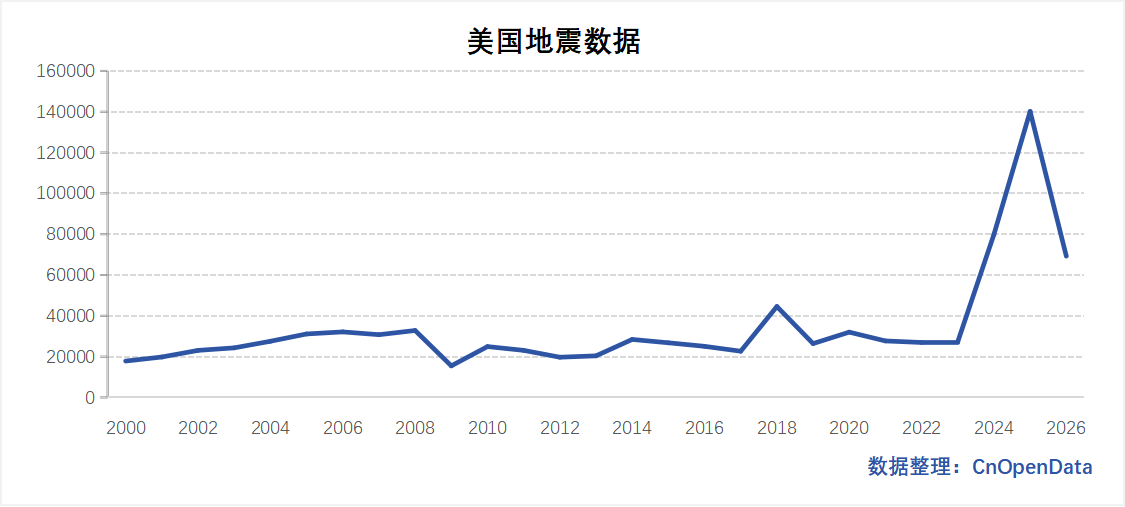
Data Scale
Field Explanation
|	美国地震信息数据	|
|	----	|
|	year	|
|	time(UTC)	|
|	place	|
|	lon	|
|	lat	|
|	depth	|
|	mag	|
|	magType	|
|	sig(2021年7月后无此字段)	|
|	net	|
|	nst	|
|	dmin	|
|	rms	|
|	gap	|
|	title	|
|	url	|
|	status	|


***
Sample Data
References
- Abbasoglu, Hilmi Bugra and Kalkan, Burak, Seismic Shifts in Property Valuations: A Salience Theory Approach to Understanding Market Reactions to Earthquake Risk (June 06, 2024).
Data Update Frequency
Annual Updates